The Determining Factors Behind Building the Apartheid Wall in Jerusalem and the West Bank
Abstract
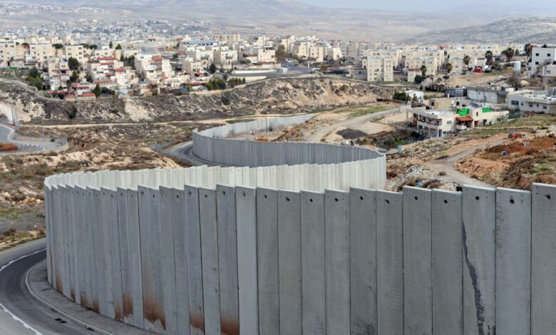
This research sheds lights on the determining factors behind building the Israeli apartheid wall, which extends in the West and the territories occupied by the Israeli occupation in 1948. The mapping is designed to cut specific areas in the West Bank and the 1948 occupied territories. It is far from reaching the Green Line territories. The research presents the main ten determining factors behind the mapping of the apartheid wall, which are: security and military concerns, annexation of territories for the sake of settlement expansion, confiscating Palestinians lands as much as possible, controlling the historical and holy sites of Palestine, controlling mountain areas, controlling fertile lands especially the ones that are rich with natural resources and water, including not the cities with enumerated population, expanding the borders of Jerusalem city as planned and called the ‘Greater Jerusalem’, and securing settlers main road networks and transportation.
The research concludes that the Israeli planners were extremely clever in mapping the apartheid wall. This was the result of in-depth study and examination of each area in the West Bank reaching the end point of it. The apartheid wall is paralyzing the life of Palestinians in the West Bank; it cuts it in violation of international laws.
To Download